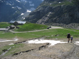
Originally built at the end of the 19th Century the Hotel Bellevue was a popular with those seeking to conquer Mont Blanc, and as reported in the French press ‘frequented by the Victorian English or bourgeois bohemians in search of thrills’. A century later, Bellevue was no more than a ruin in a fantastic location.
 The hotel is located above Les Houches at 1800 meters on the ridge linking the Bellevue telepherique with Col du Voza with a 360° view of the Chamonix Valley and the Val Montjoie & St Gervais. It is perfectly situated not only for those heading up or descending Mont Blanc but those looking for alternation accommodation for the Tour du Mont Blanc with its fantastic location.
 A green approach meant hotel without heating! As well as maintaining its original look the brief was to build an exemplary hotel in terms of impact on the site and consumption of energy. The hotel "without heat" is based on a design concept with a very low power consumption, based on the use of passive heat of the sun (solar), geothermal (7 wells, 100 m deep have been constructed around the building), optimum insulation (triple-glazed windows, wall & roof insulation) and a ventilation system that regenerates the air "old" air. The buildings consumption will be reduced to 10% of similar size hotels in similar locations.
Mont Blanc Treks 2011


