Sunday, April 24, 2011

Tour du Mont Blanc Trek 1st stage

Aiguillette des Houches- Day 2
One of the most popular long distance treks in Europe approximately 170kms in length with an accumulation of 9,500 mtrs of height gain, the Tour du Mont Blanc is truly spectacular. It can be tackled in various stages, in various lengths and in various ways. To undertake the full trek allow at least 8-9 days of trekking but as an alternative doing the TMB in half stages is a great idea if you are limited with time or want a more relaxed experience. Mont Blanc Treks offers an itinerary that allows you time to prepare by doing the Chamonix to Les Houches section of the TMB as a day walk before embarking on the 4 day hut to hut classic trek from Les Houches to Courmayeur of approximately 54kms through France & Italy. The trek also builds in time to explore Courmayeur and 1 free day to take advantage of the many excursions on offer in Chamonix.
Above the Contamines Valley- Day 4
The holiday starts when you are 

transfered from Geneva airport to the hotel in the Chamonix Valley an early evening welcome & trek briefing allowing you time after to explore the bars and restaurants for evening meal.
On day 2 we take the Brevant télépherique from Chamonix and commence a day walk within the stunning Aiguilles Rouges nature reserve and the Chamonix to Les Houches section of the TMB.

Day 3 starts from Les Houches 1007m were we take the Bellevue télépherique to gain a bit of height before climbing to the Col du Tricot at 2120m we then descend to the beautiful Chalets du Miage for a well-earned refreshment break. Continuing to Les Contamines and on to our accommodation for the night at Nant Borrant.
Italian Val Veny- Day 5
We start day 4 with a steady climb to the Col du Bonhomme 2329m and the Croix du Bonhomme 2483m where we can enjoy stunning views of Beaufortaine region of the Alps. We then descend to the remote alpine village of Chapieux where we will send the night at the Refuge de la Nova.
Day 5 takes us up to the Col du Seigne 2516m and across the Italian boarder with sunning views of the Italian side of the Mont Blanc Massif. Gaze in wonder at the Glacier de la Leé Blanche above the Refuge Elizabetta whilst we sample delicious Italian coffee. We continue along the idyllic Val Veny to our accommodation for the night at the Refuge Maison Vielle 1956m.
The last day on our trek takes from Refuge Maison Vielle to the stylish Italian village of Courmayeur in the Aosta Valley. On arrival we have time time to explore the old Italian alpine village before getting our private transfer back to Chamonix.
Refugio Maison Vielle above Courmayeur- Day 6
We reserve the final day to explore Chamonix and take advantage of the many excursions and ‘must do’ tourist attractions like the Aiguille du Midi or the Montenvers train to the Mer du Glace.
Day 8 brings our farewell and departure via private transfer to Geneva Airport.

Check out more TMB trek information at: www.montblanctreks.com

Mont Blanc Treks 2011

Saturday, April 16, 2011

Walkers Haute Route Grimentz to Zermatt

In addition to the Tour of Mont Blanc offered by Mont Blanc Treks we also focus on other classic treks in the Western Alps in particular the Walkers Haute Route. Normally the full tour is completed in 12 to 14 days from Chamonix to Zermatt. The route takes you from the Chamonix Valley in France to the Valais region of Switzerland covering 180 kilometers with ascents of 11 high mountain passes with approximately 12,000 meters of ascent. The trek includes 2 days on the classic Europaweg as we approach Zermatt. 


The Haute Route trek is also offered in two half stages Chamonix to Grimentz and Grimentz to Zermatt. Grimentz is the starting point of our second stage Haute Route trek it lies in the Valaisian Val d’Anniviers at an altitude of 1570 meters. This picture-book village famous for its granaries, which have been nearly burnt black by the sun and an abundance of traditional trailing red geraniums in the window boxes.The picturesque Valaisian village of Grimentz belongs to the municipality of Anniviers, a tour of the village reveals all of its charms for example, The Burgher House from the 15th century forms the center of the village.
On day one of our trek we head up towards the Lac Moiry with the Moiry Glacier beyond. We discover the rich variety of fauna and flora on a walk to the Moiry Reservoir and the Moiry Glacier with its Glacier Falls is one of the most spectacular in the Alps. From the Lake we gain height to the Col du Sorbois at 2836 meters our vantage point gives us great views over the Swiss Valais before we start our descent back into the Val d’Anniviers and the village of Zinal.


Join us this summer on our 2nd stage Haute Route trek from Grimentz to Zermatt, 16th to the 23rd July 2011. See www.montblanctreks.com for further details.

Click here to view the 2nd Stage Haute Route map: http://maps.google.co.uk/maps/ms?hl=en&ie=UTF8&msa=0&msid=216891430280392617790.0004a0b74f401cefa96f0&z=11
Visit the Grimentz Tourism website: http://www.grimentz-stjean.ch/fr/Regions/

Mont Blanc Treks 2011

Monday, April 4, 2011

Mont Blanc from another perspective

Given the opportunity to take a look at the Mont Blanc Massif from another angle I didn't need much persuasion. John Taylor IFMGA mountain guide who owns and runs Mont Blanc Guides and specialise in Mont Blanc ascension courses (acclimatisation treks and summits during the week with the final achievement of Mont Blanc 4810m by the end of the course). In his spare time he has achieved his light aircraft pilots licence through Megeve Aeroclub and is keen to get out to increase his flying hours. 


Trient Glacier

With a good forecast and a Sezner that was available for the morning we took the little plane built in the 1960's for a trip around the Mont Blanc Massif. A little worrying to start with as we climbed up in this little bean tin reaching in excess of 4000m. The flight was surprisingly stable until we crossed the Swiss boarder and headed over the Trient glacier. Bobbing and rolling we took a thermal to get out of the turbulence a rocky ride continued until we passed over the ridges towards the Vallee Blanche. 

Grand Jorasses

Passing the north face of the Grand Jorasses over the Gieant icefall to the Aiguille du Midi... it was a busy day descending the ridge for the off piste skiers. We exited the massif by passing Mont Blanc below the summit before heading towards the lower alps of the Aravis with Annecy beyond. After a quick coffee stop at Annecy airport we headed back over the lake to the little Altiport of Megeve.


Truly stunning to see the Mont Blanc massif in this way peering over the ridges and summits seeing ski tourers on the Winter Haute Route and the day trippers on the Vallee Blanche below.

Aiguille du Midi
Many thanks to John for the experience.

More information on John's company Mont Blanc Guides and Mont Blanc ascent courses at: www.montblancguides.com

Megeve Altiport Mont Blanc pleasure flights:

www.aerocime.com
Mont Blanc 4810m


Friday, March 25, 2011

Is this the last of the snow and last of the snowshoeing?


It is true to say it has been a funny old season on this side of Mont Blanc in terms of snow (or the lack of it!) and many of the locals have seen one like it for many a year. Days of considerable snowfall can be counted on one hand, end of November, Christmas day, Boxing day, one day in Jan and one in Feb and thats about the extent of it (of course there has been a tad more at higher altitude). Saying all of that we can't grumble as we have had week on week of sunny skies and more recently summer temperatures. Although down the far end of the valley the Grand Montets is holding up well for skiers its becoming increasingly hard to find good quality snowshoe treks. 


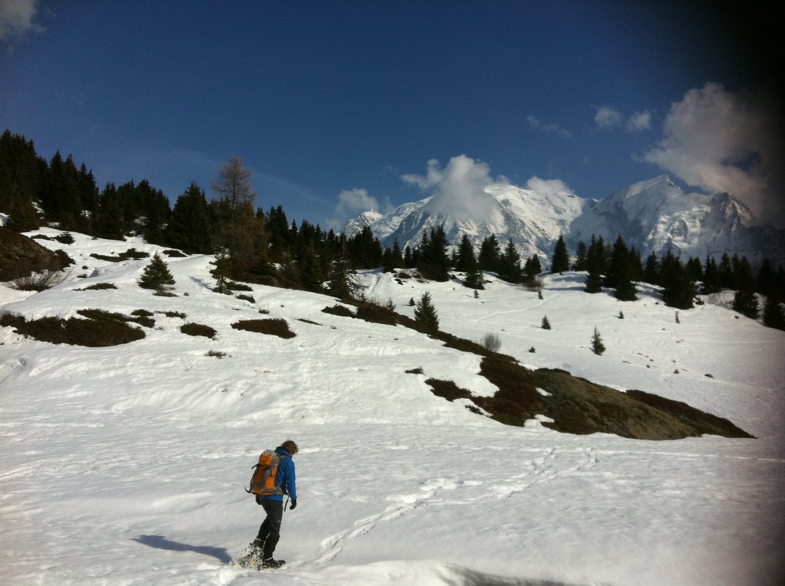
Half day snowshoe above Les Houches proved heavy going today, we took he Prarion lift gaining height quickly taking us above the snowline to 1850 mtrs. We took a short circular walk from the lift towards the summit of the Prarion at 1903 mtrs, the snow was heavy, waterlogged and proved hard going as is collapsed with every other step. However the great weather, temperatures of 15 degs and fabulous views made up for the difficult conditions under foot. Is this the last of the snow and last of the snowshoeing? it feels that way.... Looks like the Mont Blanc trekking season will start early this year. 

Visit our website to find out more about what we do: www.montblanctreks.com

Wednesday, March 23, 2011

Chalet construction in the Mont Blanc region of the Haute Savoie

Continuing the theme of things to see whilst out and about walking, trekking & snowshoeing in the middle mountains around the Mont Blanc massif, we turned our attentions to the many chalets and farmsteads dotted around the hillside. 


The term Chalet means hut of a hearder and comes from the Arpitian speaking part of Switzerland and the old Savoy region of the Western Alps in the 14-century. 
This was traditionally a farm dwelling that supports herds of cattle producing cheese & butter and a seasonal building in high valleys or pastures that supported transhumance which is the movement of farming communities to higher terrain during the summer months as cattle were brought up from lower levels to the summer Alpage (high mountain pastureland and farmstead).

A wooden dwelling that was traditionally built from Larch. Larch was used because of its availability in the area and for its strong, durable, waterproof and rot resistant properties. These days spruce is used for the construction of new chalets as it is more financially viable. 

The buildings have sloping overhanging roofs that when loaded with snow provided insulation. They were constructed on a south facing aspect to gain maximum sun light and warmth during the cold winters. The design featured a stone base on the ground floor with a wooden frame and waney lap above that insulated against drafts and cold winds. The Cortiena or the entrance is normally a large space with the main door set back, again this was again for insulation during the long cold winters. The living area ‘Pele’ was traditionally on the second level. The livestock and farms shared the same building, the animals on ground level, easy access from the pastures and generating heat to the rest of the building. The top floor was used as the hayloft storing feed but at the same time creating insulation from above.  


Friday, March 11, 2011

Mont Blanc Winter Flora

Usnea- Old Mans Beard
During the summer the hills are alive with an abundance of flora of un-imaginable proportions. Last year on one Tour du Mont Blanc Trek we recorded approximately 50 different types of alpine flowers. 


But what is there to see whilst trekking (on snowshoes) around the Mont Blanc massif during winter? I suppose this winter you can see a little more than usual because of the limited snowfall and the warmer than usual temperatures but you would be surprised what you can see & identify.


Reindeer Lichen


No flowers but plenty to see... lichens, mosses, trees & animal tracks. Its a fairly complex task identifying things in the midst this winter wonderland but a camera whilst out and about and the internet in the comfort of your own home when you return most things can be identified.


Norway Spruce
Larch
The Pine family: the Mont Blanc region of the french alps has lots of them! & there are 7 species throughout made up of Firs, Spruces, Larches & Pines. The Norway spruce can be identified by the thin feathery needles and long cones that hang down. Larch is fairly common in the valley easily identified as it looses its needles in autumn and has small round cones that are left on the branches after the needles have dropped. Arrola pine found in abundance down the far end of the valley towards Le Tour & Vallorcine, sorter in height thick bushy branches with needles in 5's and slightly blueish on the inner surface with cones are large & round. Silver fir can be seen around with smooth white-gray bark, needles are flat and on one plane with white stripes underneath & their cones are upright.


Grey Alder 
Deciduous trees are a little harder to work out, the valley is full of a whole host of species Beech, Birch, Ash to name a few. Birch family: The green Alder is not that noticeable in winter although it comes to good use, it grows up to 3m tall branches are flexible and can withstand the weight of the winter snow, these can often be found in slopes, gullies and stream banks and act as a natural avalanche barrier. A good one to look out for in the winter is the Grey Alder, It can be identified by the small cones that are dotted around the branches, strange for an deciduous to have cones. 

More on Flora when the weather gets warmer!

Friday, March 4, 2011

Avalanche transceiver refresher

You might think with snowshoeing treks there would be little or no risk but to the contrairy if you are trekking in an area with snow there will be hazards. Often when snowshoeing the hazards are from above, you might be traveling along an easy track in the valley bottom but above you might be slopes that are completely loaded and ready to deposit volumes of snow on the valley below. many of the more adventuress snowshoe routes venture into areas that have avalanche risk and many of the guide books give information  on slopes that can be potentially hazardous.

From the Prarion towards the Aravis
As an International Mountain Leader you required to have an underlying knowlegde of safe travel in the middle mountains in summer and winter. Assessing avalanche risk and be able to use and teach the practical application of avalanche transceivers is a pre-requisite of the qualification.  Although this season hasn't demanded a massive amount of transceiver use becuase of the low avalanche risk in the middle mountains it is essential that you undertake regular refreshers in search and rescue so itf anything does go wrong you are able to act fast.


Mont Blanc from the roof of the Prarion telepherique
So we ventured out using the Prarion telepherique to get us up to 1850 mtrs so we had the use of deeper snow. From the top of the lift  we took the track to the right that leads you over the top of the telepherique. At this point we followed the snowshoe tracks towards the summit of the Prarion at 
1902 mtrs and found an area that was quet and open with plenty of reasonably deep snow.


ARVA avalanche transceiver
Electromagnetic signal
Starting with the avalanche basics... how does the transceiver work, how does it transmit? we were using ARVA devises which have a duel antenna this is a reasonable and afordable unit. Wearing the unit close to your body it is activated by plugging in the strap around the body to enable SOS mode. The unit transmits a series of signals that leave and return to the unit in an consentric pattern. The search devise is enabled in search mode and locks in to one of the transmission radiuses and takes you in an arc back to the victim.

Following the direction, distance and bleep indicator to home
 in on the victims transceiver
Once a signal is detected (on the ARVA) it is indicated by 3 ways... on an LED screen by distance in meters and arrow to show you direction of signal plus bleep (distance between bleeps gets shorter the nearer to the victim). Following the direction of the arrow, reducing the distance and listening to the bleep will hopefully lead you to the vicim.


Micro grid search at ground level
When the distance has been reduced to a couple of meters move the transceiver to just above the surface of the snow. Move it forward and back and keeping the unit in the same plane at all times you need to find the transceivers stronget signal (beeps closet together and minimal distance). At the strongest point move the unit laterally again mark the lowest distance to form a cross. At this point its time to start probing starting and the marked point and moving out in a spiral plunging the probe perpendicular to the slope and feeling for something soft opposed to hard and frozen snow or ground. 


Probing to find the victim
Once the victim is located (in our case the ruck sac with transceiver inside) we started to dig. Time is of the essence as generally people cannot survive over 20 mins under avalanche debris. Obviously it would get a little more complex if multiple victims need to be located and a whole range of techniques need to be adopted. Successful rescue is totally dependant on the speed of recovery, team work and an effective rescue approach are essential


Digging to find the victim


In practice it all seems reasonable and do-able, in reality under the panic of a real life emergency it must be truly terrifying especially when searching for close friends or family or clients... time its the crucial factor here so by being totally comfortable with the methods, if in this unfortunate situation arises being prepared would make the chances of success more feasible.


For more information of avalanche awareness & rescue see: 
http://www.avalanche.org/tutorial/tutorial.html


For avalanche awareness courses see:
http://www.chamex.com/courses/avalanche-awareness